
Mapa topográfico 'Amanave
Mapa interactivo
Haga clic en el mapa para ver la altitud.
'Amanave
'Amanave was severely damaged by the 2009 tsunami. However, of a population of about 500 residents, no deaths were recorded. When the tsunami approached, emergency information was sent by radio and a bell rang in the village. After the tsunami, some residents followed the advice of the Federal Emergency Management Agency (FEMA) and moved into houses on a higher elevation.
Acerca de este mapa
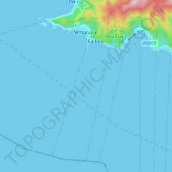
Nombre: Mapa topográfico 'Amanave, altitud, relieve.
Altitud media: 23 m
Altitud mínima: 0 m
Altitud máxima: 372 m