
Haz una donación
Mapa topográfico Craigs Creek
Haga clic en el mapa para ver la altitud.
Haz una donación
Acerca de este mapa
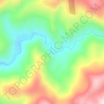
Nombre: Mapa topográfico Craigs Creek, altitud, relieve.
Lugar: Craigs Creek, Del Norte County, California, United States (41.79646 -123.99501 41.79717 -123.99447)
Altitud media: 356 m
Altitud mínima: 110 m
Altitud máxima: 691 m
Haz una donación
Otros mapas topográficos
Haga clic en un mapa para ver su topografía, su altitud y su relieve.
Redwood National Park
United States > California > Del Norte County
Redwoods prefer sheltered slopes, and they thrive on moist flat ground along rivers below 1,000 feet (300 m) in elevation. Coastal fog provides about 40 percent of their annual water intake. Redwoods have existed along the coast of northern California for at least 20 million years and are related to tree…
Altitud media: 367 m
Haz una donación
Hiouchi
United States > California > Del Norte County
Hiouchi (Tolowa: Xaa-yuu-chit) is a census-designated place in Del Norte County, California. It is located on the Smith River 7.5 miles (12 km) east-northeast of Crescent City, at an elevation of 171 feet (52 m). Its population is 314 as of the 2020 census, up from 301 from the 2010 census.
Altitud media: 162 m
Redwood National and State Parks
United States > California > Del Norte County
Redwoods prefer sheltered slopes, and they thrive on moist flat ground along rivers below 1,000 feet (300 m) in elevation. Coastal fog provides about 40 percent of their annual water intake. Redwoods have existed along the coast of northern California for at least 20 million years and are related to tree…
Altitud media: 324 m
Haz una donación