
Mapa topográfico Whittle Springs
Mapa interactivo
Haga clic en el mapa para ver la altitud.
Acerca de este mapa
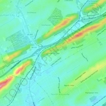
Nombre: Mapa topográfico Whittle Springs, altitud, relieve.
Altitud media: 311 m
Altitud mínima: 283 m
Altitud máxima: 398 m
Otros mapas topográficos
Haga clic en un mapa para ver su topografía, su altitud y su relieve.
Dead Horse Lake
United States > Tennessee > Knox County > Knoxville
Dead Horse Lake, Cedar Bluff, Knoxville, Knox County, East Tennessee, Tennessee, United States
Altitud media: 296 m
Shannondale
United States > Tennessee > Knox County > Knoxville
Shannondale, Knoxville, Knox County, East Tennessee, Tennessee, 37918, United States
Altitud media: 334 m
Knoxville
United States > Tennessee > Knox County > Knoxville
Knoxville, Knox County, Tennessee, 37996-4134, United States
Altitud media: 304 m
Vestal
United States > Tennessee > Knox County > Knoxville > Vestal
Vestal, Knoxville, Knox County, Tennessee, 37920, United States
Altitud media: 284 m