
Mapa topográfico Walnut Hill
Haga clic en el mapa para ver la altitud.
Acerca de este mapa
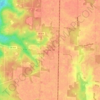
Nombre: Mapa topográfico Walnut Hill, altitud, relieve.
Lugar: Walnut Hill, Escambia County, Florida, United States (30.86546 -87.52998 30.90546 -87.48998)
Altitud media: 74 m
Altitud mínima: 37 m
Altitud máxima: 83 m
Otros mapas topográficos
Haga clic en un mapa para ver su topografía, su altitud y su relieve.
Pensacola
United States > Florida > Escambia County
The land is sloped up northward from Pensacola Bay, with most of the city at an elevation above that which a potential hurricane storm surge could affect.
Altitud media: 21 m
Pensacola
United States > Florida > Escambia County
Pensacola features a diverse topography characterized primarily by its proximity to the Gulf of Mexico and the sheltered Pensacola Bay. The terrain gently slopes upward from the waterfront, resulting in a gradual elevation that provides natural protection against storm surges, making it somewhat less…
Altitud media: 21 m
Pensacola
United States > Florida > Escambia County
The land is sloped up northward from Pensacola Bay, with most of the city at an elevation above that which a potential hurricane storm surge could affect.
Altitud media: 21 m
Pensacola
United States > Florida > Escambia County
The land is sloped up northward from Pensacola Bay, with most of the city at an elevation above that at which a potential hurricane storm surge could affect.
Altitud media: 21 m
Pensacola
United States > Florida > Escambia County
The land is sloped up northward from Pensacola Bay, with most of the city at an elevation above that at which a potential hurricane storm surge could affect.
Altitud media: 21 m
Pensacola
United States > Florida > Escambia County
The land is sloped up northward from Pensacola Bay, with most of the city at an elevation above that at which a potential hurricane storm surge could affect.
Altitud media: 21 m