
Mapa topográfico Andreas
Mapa interactivo
Haga clic en el mapa para ver la altitud.
Acerca de este mapa
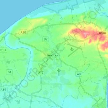
Nombre: Mapa topográfico Andreas, altitud, relieve.
Lugar: Andreas, Ayre, Isle of Man (54.33226 -4.50079 54.40369 -4.40378)
Altitud media: 20 m
Altitud mínima: 0 m
Altitud máxima: 95 m
Otros mapas topográficos
Haga clic en un mapa para ver su topografía, su altitud y su relieve.
Yellow Stone
Isle of Man > Ayre > Lezayre
Yellow Stone, Lezayre, Ayre, IM4 7NY, Isle of Man
Altitud media: 407 m