
Gracias por apoyar a este sitio ❤️
Haz una donación
Haz una donación
Mapa topográfico Moselle
Haga clic en el mapa para ver la altitud.
Gracias por apoyar a este sitio ❤️
Haz una donación
Haz una donación
Acerca de este mapa
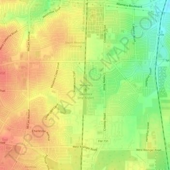
Nombre: Mapa topográfico Moselle, altitud, relieve.
Altitud media: 233 m
Altitud mínima: 204 m
Altitud máxima: 252 m
Gracias por apoyar a este sitio ❤️
Haz una donación
Haz una donación
Otros mapas topográficos
Haga clic en un mapa para ver su topografía, su altitud y su relieve.
Benbrook Lake
United States > Texas > Tarrant County > Fort Worth
Construction of Benbrook dam began in May 1947, and was practically completed when floodgates were closed and deliberate impoundment was begun in September 1952. The cost to build the lake was $14.5 million ($112 million in 2007 dollars). The rolled-earth embankment is 9,130 feet (2,783 m) in length, including…
Altitud media: 228 m
Gracias por apoyar a este sitio ❤️
Haz una donación
Haz una donación