
Mapa topográfico Conservation Land (Trails)
Mapa interactivo
Haga clic en el mapa para ver la altitud.
Acerca de este mapa
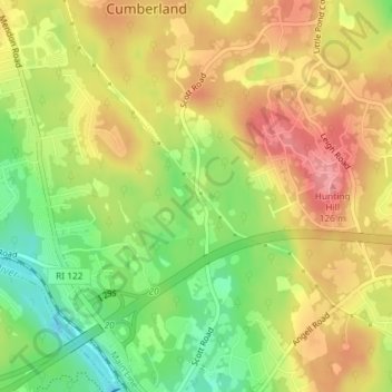
Nombre: Mapa topográfico Conservation Land (Trails), altitud, relieve.
Altitud media: 73 m
Altitud mínima: 16 m
Altitud máxima: 123 m
Otros mapas topográficos
Haga clic en un mapa para ver su topografía, su altitud y su relieve.
Ashton
United States > Rhode Island > Providence County > Cumberland
Ashton, Cumberland, Providence County, Rhode Island, 02864, United States
Altitud media: 60 m