
Haz una donación
Mapa topográfico Faucett
Haga clic en el mapa para ver la altitud.
Haz una donación
Acerca de este mapa
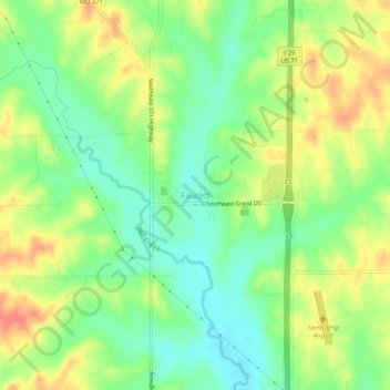
Nombre: Mapa topográfico Faucett, altitud, relieve.
Lugar: Faucett, Buchanan County, Missouri, 64448, United States (39.58060 -94.82102 39.62060 -94.78102)
Altitud media: 305 m
Altitud mínima: 280 m
Altitud máxima: 335 m
Haz una donación
Otros mapas topográficos
Haga clic en un mapa para ver su topografía, su altitud y su relieve.
Saint Joseph
United States > Missouri > Buchanan County
Under the Köppen climate classification, St. Joseph has a humid subtropical climate (Cfa) bordering on a humid continental climate (Dfa), although under United States isotherms of 32 °F (0 °C) the station is firmly continental. The monthly weather averages listed below are taken from National Weather…
Altitud media: 277 m
Haz una donación