
Haz una donación
Mapa topográfico Cache Lake
Haga clic en el mapa para ver la altitud.
Haz una donación
Acerca de este mapa
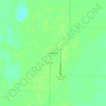
Nombre: Mapa topográfico Cache Lake, altitud, relieve.
Lugar: Cache Lake, Clay County, Arkansas, 72435, United States (36.27562 -90.55316 36.31562 -90.51316)
Altitud media: 88 m
Altitud mínima: 80 m
Altitud máxima: 91 m
Haz una donación
Otros mapas topográficos
Haga clic en un mapa para ver su topografía, su altitud y su relieve.
Piggott
United States > Arkansas > Clay County
The topography of Piggott is mostly flat in the eastern half of the city with the more developed western half lying along Crowley’s Ridge, creating a sensation of coming down from a small mount to the flatland below. This ridge is a naturally occurring phenomenon created over millennia by wind-blown…
Altitud media: 103 m
Corning
United States > Arkansas > Clay County
The topography of Corning is flat, having previously been marshland. Area farmers and builders may attest to this due to the proliferation of gumbo soil, a name given to soil high in clay particulate matter and common in the region.
Altitud media: 88 m