
Gracias por apoyar a este sitio ❤️
Haz una donación
Haz una donación
Mapa topográfico Batajnica
Haga clic en el mapa para ver la altitud.
Gracias por apoyar a este sitio ❤️
Haz una donación
Haz una donación
Acerca de este mapa
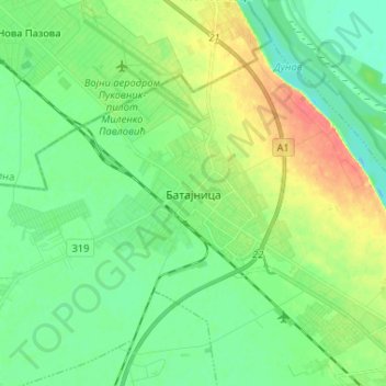
Nombre: Mapa topográfico Batajnica, altitud, relieve.
Altitud media: 81 m
Altitud mínima: 65 m
Altitud máxima: 112 m
Gracias por apoyar a este sitio ❤️
Haz una donación
Haz una donación
Otros mapas topográficos
Haga clic en un mapa para ver su topografía, su altitud y su relieve.
Hotel Jugoslavija
Serbia > Central Serbia > City of Belgrade > Belgrade
The station was operational until 1970. To commemorate it, architect Milun Stambolić designed a memorial complex which consists of 5 pillars, which used to hold the station's overhang, and several meters of railroad tracks. The complex is placed on the plateau next to the hotel, on the small elevation above…
Altitud media: 77 m