
Mapa topográfico Dennisville
Mapa interactivo
Haga clic en el mapa para ver la altitud.
Acerca de este mapa
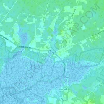
Nombre: Mapa topográfico Dennisville, altitud, relieve.
Altitud media: 3 m
Altitud mínima: -4 m
Altitud máxima: 11 m
Otros mapas topográficos
Haga clic en un mapa para ver su topografía, su altitud y su relieve.
Maple Swamp
United States > New Jersey > Cape May County > Dennis Township
Maple Swamp, Dennis Township, Cape May County, New Jersey, 08230, United States
Altitud media: 2 m