
Gracias por apoyar a este sitio ❤️
Haz una donación
Haz una donación
Mapa topográfico Scott City
Haga clic en el mapa para ver la altitud.
Gracias por apoyar a este sitio ❤️
Haz una donación
Haz una donación
Scott City
According to the United States Census Bureau, the city has a total area of 2.63 square miles (6.81 km2), all land. It is located in the Great Plains and at the elevation of 2979 ft.
Gracias por apoyar a este sitio ❤️
Haz una donación
Haz una donación
Acerca de este mapa
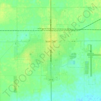
Nombre: Mapa topográfico Scott City, altitud, relieve.
Lugar: Scott City, Scott County, Kansas, 67871, United States (38.46398 -100.92538 38.49309 -100.87013)
Altitud media: 903 m
Altitud mínima: 894 m
Altitud máxima: 910 m
Gracias por apoyar a este sitio ❤️
Haz una donación
Haz una donación