
Mapa topográfico Loughgall
Mapa interactivo
Haga clic en el mapa para ver la altitud.
Acerca de este mapa
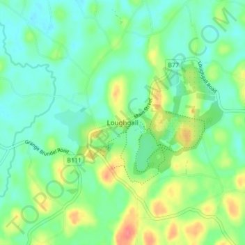
Nombre: Mapa topográfico Loughgall, altitud, relieve.
Altitud media: 32 m
Altitud mínima: 12 m
Altitud máxima: 74 m
Otros mapas topográficos
Haga clic en un mapa para ver su topografía, su altitud y su relieve.
Portadown
United Kingdom > Northern Ireland > County Armagh
Portadown, County Armagh, Ulster, Northern Ireland, BT62 1BF, United Kingdom
Altitud media: 28 m
Armagh
United Kingdom > Northern Ireland > County Armagh > Armagh
Armagh, County Armagh, Ulster, Northern Ireland, United Kingdom
Altitud media: 100 m
Lurgan
United Kingdom > Northern Ireland > County Armagh > Lurgan
Lurgan, County Armagh, Northern Ireland, United Kingdom
Altitud media: 48 m