
Mapa topográfico 索乎日麻乡
Mapa interactivo
Haga clic en el mapa para ver la altitud.
Acerca de este mapa
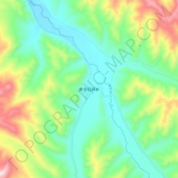
Nombre: Mapa topográfico 索乎日麻乡, altitud, relieve.
Lugar: 索乎日麻乡, 久治县, 果洛藏族自治州, 青海省, 中国 (33.49166 100.89388 33.57166 100.97388)
Altitud media: 4.029 m
Altitud mínima: 3.798 m
Altitud máxima: 4.546 m
Otros mapas topográficos
Haga clic en un mapa para ver su topografía, su altitud y su relieve.