
Mapa topográfico Mooney Mountain Park
Mapa interactivo
Haga clic en el mapa para ver la altitud.
Acerca de este mapa
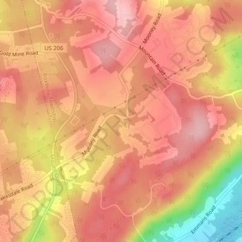
Nombre: Mapa topográfico Mooney Mountain Park, altitud, relieve.
Altitud media: 326 m
Altitud mínima: 219 m
Altitud máxima: 370 m
Otros mapas topográficos
Haga clic en un mapa para ver su topografía, su altitud y su relieve.
Roxbury Township
United States > New Jersey > Morris County > Roxbury Township
Roxbury Township, Morris County, New Jersey, 07852, United States
Altitud media: 264 m
Roxbury Township
United States > New Jersey > Morris County > Roxbury Township
Roxbury Township, Morris County, New Jersey, United States
Altitud media: 268 m