
Mapa topográfico Tinian Island
Mapa interactivo
Haga clic en el mapa para ver la altitud.
Acerca de este mapa
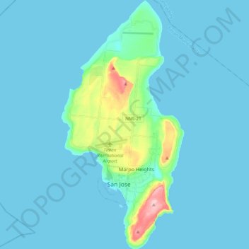
Nombre: Mapa topográfico Tinian Island, altitud, relieve.
Altitud media: 17 m
Altitud mínima: 0 m
Altitud máxima: 187 m
Tinian is about 5 nautical miles (9.3 km) southwest of Saipan, from which it is separated by the Saipan Channel. It has a land area of 39 square miles (100 km2), with its highest elevation at Mount Lasso at 171 meters (561 ft).