
Mapa topográfico San Narciso
Mapa interactivo
Haga clic en el mapa para ver la altitud.
Acerca de este mapa
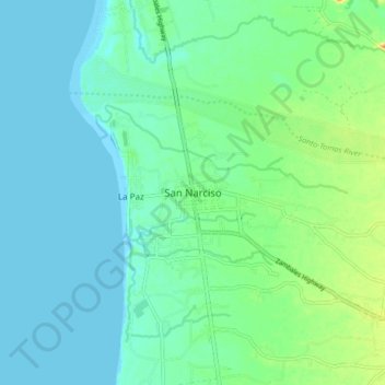
Nombre: Mapa topográfico San Narciso, altitud, relieve.
Lugar: San Narciso, Zambales, Central Luzon, 2205, Philippines (14.97552 120.03937 15.05552 120.11937)
Altitud media: 11 m
Altitud mínima: 0 m
Altitud máxima: 43 m
San Narciso is located in a relatively flat plain. West of the town is the South China Sea and to the east is bordered by the Sto. Tomas river are the Zambales Mountain Ranges. Average elevation is 3.6 metres (12 ft) above sea level and the highest elevation is 800 metres (2,600 ft) above sea level.