
Mapa topográfico Howden
Haga clic en el mapa para ver la altitud.
Acerca de este mapa
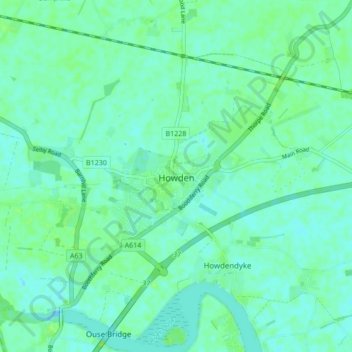
Nombre: Mapa topográfico Howden, altitud, relieve.
Lugar: Howden, East Riding of Yorkshire, England, United Kingdom (53.72232 -0.89837 53.77271 -0.84159)
Altitud media: 4 m
Altitud mínima: -3 m
Altitud máxima: 11 m
Otros mapas topográficos
Haga clic en un mapa para ver su topografía, su altitud y su relieve.
Airedale
United Kingdom > England > East Riding of Yorkshire
Airedale, in conjunction with the Ribble Valley, provides low-altitude passes from Yorkshire to Lancashire through the Aire Gap. It is therefore an important transport route and was a strategically important area historically.
Altitud media: 60 m
East Cottingwith
United Kingdom > England > East Riding of Yorkshire > East Cottingwith
Altitud media: 8 m
Malton Lane Plantation
United Kingdom > England > East Riding of Yorkshire > Bugthorpe
Altitud media: 54 m
Burton Constable Hall
United Kingdom > England > East Riding of Yorkshire > West Newton
Altitud media: 18 m
Willerby and Derringham Flood Alleviation Scheme
United Kingdom > England > East Riding of Yorkshire > Kirk Ella
Altitud media: 42 m