
Mapa topográfico Aston upon Trent CP
Mapa interactivo
Haga clic en el mapa para ver la altitud.
Acerca de este mapa
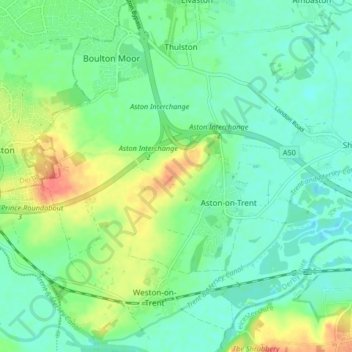
Nombre: Mapa topográfico Aston upon Trent CP, altitud, relieve.
Altitud media: 45 m
Altitud mínima: 28 m
Altitud máxima: 80 m
Otros mapas topográficos
Haga clic en un mapa para ver su topografía, su altitud y su relieve.
Ticknall CP
United Kingdom > England > South Derbyshire > Ticknall CP
Ticknall CP, South Derbyshire, Derbyshire, East Midlands, England, United Kingdom
Altitud media: 112 m