
Haz una donación
Mapa topográfico Cenej
Haga clic en el mapa para ver la altitud.
Haz una donación
Acerca de este mapa
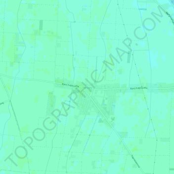
Nombre: Mapa topográfico Cenej, altitud, relieve.
Altitud media: 82 m
Altitud mínima: 78 m
Altitud máxima: 85 m
Haz una donación
Otros mapas topográficos
Haga clic en un mapa para ver su topografía, su altitud y su relieve.
Novi Sad
Serbia > Vojvodina > South Backa Administrative District
The city lies on the meander of the river Danube, which is only 350 meters wide beneath the marking stones of Petrovaradin. A section of the Danube-Tisza-Danube Canal marks the northern edge of the wider city centre. The main part of the city lies on the left bank of the Danube in the region of Bačka, while…
Altitud media: 83 m
Maglic
Serbia > Vojvodina > South Backa Administrative District > Backi Petrovac Municipality
Altitud media: 83 m
Vizic
Serbia > Vojvodina > South Backa Administrative District > Backa Palanka Municipality
Altitud media: 196 m
Haz una donación
Novi Sad
Serbia > Vojvodina > South Backa Administrative District
The city lies on the meander of the river Danube, which is only 350 meters wide beneath the marking stones of Petrovaradin. A section of the Danube-Tisza-Danube Canal marks the northern edge of the wider city centre. The main part of the city lies on the left bank of the Danube in the region of Bačka, while…
Altitud media: 83 m
Bačka Palanka
Serbia > Vojvodina > South Backa Administrative District > Backa Palanka Municipality
Altitud media: 89 m
Gardinovci
Serbia > Vojvodina > South Backa Administrative District > Titel Municipality
Altitud media: 78 m
Haz una donación
Sremski Karlovci Municipality
Serbia > Vojvodina > South Backa Administrative District
Altitud media: 178 m
Petrovaradin
Serbia > Vojvodina > South Backa Administrative District
Petrovaradin is located in the Syrmia region, on the Danube river and Fruška Gora, a horst mountain with elevation of 78–220 m (municipality up to 451 m). The northern part of Fruška Gora consists of massive landslide zones, but they are not active, except in Ribnjak neighborhood (between Sremska Kamenica…
Altitud media: 105 m
Becej
Serbia > Vojvodina > South Backa Administrative District > Becej Municipality
Altitud media: 79 m
Backi Jarak
Serbia > Vojvodina > South Backa Administrative District > Temerin Municipality
Altitud media: 82 m
Haz una donación
Backi Jarak
Serbia > Vojvodina > South Backa Administrative District > Temerin Municipality
Altitud media: 82 m
Novi Sad
Serbia > Vojvodina > South Backa Administrative District
The city lies on the meander of the river Danube, which is only 350 meters wide beneath the marking stones of Petrovaradin. A section of the Danube-Tisza-Danube Canal marks the northern edge of the wider city centre. The main part of the city lies on the left bank of the Danube in the region of Bačka, while…
Altitud media: 83 m
Haz una donación
Beocin
Serbia > Vojvodina > South Backa Administrative District > Beocin Municipality
Altitud media: 226 m
Agla
Serbia > Vojvodina > South Backa Administrative District > Titel Municipality > Gardinovci
Altitud media: 76 m
Haz una donación
Bačka Palanka
Serbia > Vojvodina > South Backa Administrative District > Backa Palanka Municipality
Altitud media: 89 m
Novi Sad
Serbia > Vojvodina > South Backa Administrative District
The city lies on the meander of the river Danube, which is only 350 meters wide beneath the marking stones of Petrovaradin. A section of the Danube-Tisza-Danube Canal marks the northern edge of the wider city centre. The main part of the city lies on the left bank of the Danube in the region of Bačka, while…
Altitud media: 83 m
Haz una donación