
Haz una donación
Mapa topográfico Mount Aniakchak
Haga clic en el mapa para ver la altitud.
Haz una donación
Mount Aniakchak
Milky-green Surprise Lake has an area of 2.75 square kilometers (1.06 sq mi) and abuts the inner northeastern margin of the caldera. Its water is about 19.5 meters (64 ft) deep and originates from various hot springs, cold springs and meltwater. Lake waters are continually mixed by strong winds. Hydrothermal inputs give the lake its color. The lake, which formed behind the deltas of several creeks, drains through The Gates valley at 335 meters (1,099 ft) elevation above sea level in the eastern caldera rim, the only outlet of the caldera. The outlet forms the Aniakchak River, a National Wild and Scenic River flowing to the Pacific Ocean. In 2010, one of the maars in the caldera broke out, causing a flood in the Aniakchak River. Meshik Lake is south of the caldera. The Meshik and Cinder Rivers drain the rest of the volcanic edifice, to Bristol Bay. A 1 square kilometer (0.39 sq mi) debris-covered glacier is in the southern sector of the caldera and has emplaced moraines. Other small glaciers have developed on Aniakchak Peak and Vent Mountain. Landslides have affected the eastern walls of the caldera.
Haz una donación
Acerca de este mapa
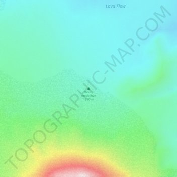
Nombre: Mapa topográfico Mount Aniakchak, altitud, relieve.
Altitud media: 483 m
Altitud mínima: 357 m
Altitud máxima: 889 m
Haz una donación
Otros mapas topográficos
Haga clic en un mapa para ver su topografía, su altitud y su relieve.