
Gracias por apoyar a este sitio ❤️
Haz una donación
Haz una donación
Mapa topográfico Brooklyn Bridge Park
Haga clic en el mapa para ver la altitud.
Gracias por apoyar a este sitio ❤️
Haz una donación
Haz una donación
Brooklyn Bridge Park
Brooklyn Bridge Park spans 85 acres (34 ha) of the East River waterfront in the Brooklyn Heights and Dumbo neighborhoods of Brooklyn. The park is divided into eleven sections: Piers 1 through 6; Fulton Ferry Landing; Brooklyn Bridge Plaza; Empire Fulton Ferry; Main Street; and John Street. Each of these sections features unique topographies, plantings, amenities, and cultural artifacts and installations, and the Brooklyn–Queens Greenway spans the park, as does the Brooklyn Waterfront Greenway.
Gracias por apoyar a este sitio ❤️
Haz una donación
Haz una donación
Acerca de este mapa
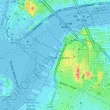
Nombre: Mapa topográfico Brooklyn Bridge Park, altitud, relieve.
Altitud media: 9 m
Altitud mínima: -6 m
Altitud máxima: 56 m
Gracias por apoyar a este sitio ❤️
Haz una donación
Haz una donación
Otros mapas topográficos
Haga clic en un mapa para ver su topografía, su altitud y su relieve.
Gracias por apoyar a este sitio ❤️
Haz una donación
Haz una donación
Gracias por apoyar a este sitio ❤️
Haz una donación
Haz una donación
Gracias por apoyar a este sitio ❤️
Haz una donación
Haz una donación