
Mapa topográfico Ganges
Mapa interactivo
Haga clic en el mapa para ver la altitud.
Acerca de este mapa
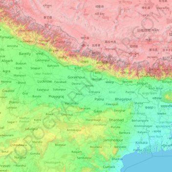
Nombre: Mapa topográfico Ganges, altitud, relieve.
Lugar: Ganges, Ghazipur, Uttar Pradesh, 233001, India (22.35753 77.99967 30.14509 91.25706)
Altitud media: 1.626 m
Altitud mínima: -2 m
Altitud máxima: 8.096 m
The upper phase of the river Ganges begins at the confluence of the Bhagirathi and Alaknanda rivers in the town of Devprayag in the Garhwal division of the Indian state of Uttarakhand. The Bhagirathi is considered to be the source in Hindu culture and mythology, although the Alaknanda is longer, and therefore, hydrologically the source stream. The headwaters of the Alakananda are formed by snow melt from peaks such as Nanda Devi, Trisul, and Kamet. The Bhagirathi rises at the foot of Gangotri Glacier, at Gomukh, at an elevation of 4,356 m (14,291 ft) and being mythologically referred to as residing in the matted locks of Shiva; symbolically Tapovan, which is a meadow of ethereal beauty at the feet of Mount Shivling, just 5 km (3.1 mi) away.