
Gracias por apoyar a este sitio ❤️
Haz una donación
Haz una donación
Mapa topográfico Dankuni
Haga clic en el mapa para ver la altitud.
Gracias por apoyar a este sitio ❤️
Haz una donación
Haz una donación
Dankuni
Located at an elevation of None meters (0 feet) above sea level, city's yearly temperature is 30.28 °C (86.5 °F) and it is 4.31% higher than India's averages. Dankuni typically receives about 150.21 millimeters (5.91 inches) of precipitation and has 150.54 rainy days (41.24% of the time) annually.
Gracias por apoyar a este sitio ❤️
Haz una donación
Haz una donación
Acerca de este mapa
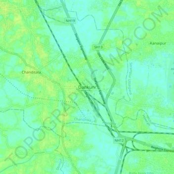
Nombre: Mapa topográfico Dankuni, altitud, relieve.
Lugar: Dankuni, Chanditala - II, Hooghly, West Bengal, 712311, India (22.64209 88.25074 22.72209 88.33074)
Altitud media: 6 m
Altitud mínima: 0 m
Altitud máxima: 11 m
Gracias por apoyar a este sitio ❤️
Haz una donación
Haz una donación