
Gracias por apoyar a este sitio ❤️
Haz una donación
Haz una donación
Mapa topográfico Maluru
Haga clic en el mapa para ver la altitud.
Gracias por apoyar a este sitio ❤️
Haz una donación
Haz una donación
Maluru
Malur is located at 13°00′N 77°56′E / 13.00°N 77.94°E / 13.00; 77.94. It has an average elevation of 910 metres (2,990 ft). It has a Tropical wet and dry climate, similar to Bangalore. It has summer temperatures rarely crossing 37°C, and winter temperatures rarely falling below 15°C.
Gracias por apoyar a este sitio ❤️
Haz una donación
Haz una donación
Acerca de este mapa
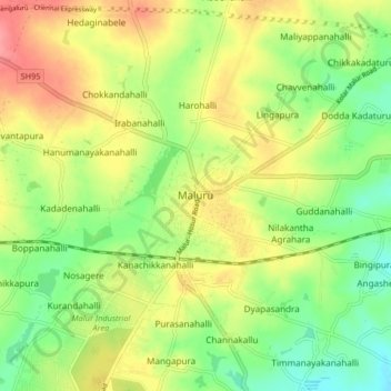
Nombre: Mapa topográfico Maluru, altitud, relieve.
Lugar: Maluru, Maluru taluk, Kolar District, Karnataka, 562116, India (12.96603 77.89828 13.04603 77.97828)
Altitud media: 899 m
Altitud mínima: 863 m
Altitud máxima: 940 m
Gracias por apoyar a este sitio ❤️
Haz una donación
Haz una donación