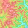
Mapa topográfico Middle Tennessee
Haga clic en el mapa para ver la altitud.
Middle Tennessee
The Highland Rim is often divided into eastern and western halves. The Eastern Highland Rim is relatively flat, with gentle rolling hills, and the eastern Nashville Basin has similar terrain but is dotted with more distinct hills in places. The western Nashville Basin and Western Highland Rim are more rugged, consisting of irregular knob-like hills separated by steep ravines and crooked stream valleys. The eastern Highland Rim has a higher average elevation, however, than the western portion. The eastern portion of Middle Tennessee consists of the western portion of the Cumberland Plateau, part of the larger Appalachian Plateau of the Appalachian Mountains.
Acerca de este mapa
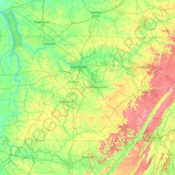
Nombre: Mapa topográfico Middle Tennessee, altitud, relieve.
Lugar: Middle Tennessee, Tennessee, United States (34.98825 -88.07053 36.67812 -84.65953)
Altitud media: 251 m
Altitud mínima: 96 m
Altitud máxima: 874 m
Otros mapas topográficos
Haga clic en un mapa para ver su topografía, su altitud y su relieve.
Cordova
United States > Tennessee > Shelby County > Memphis
Cordova is a community in Shelby County, Tennessee, United States. Cordova lies east of Memphis, north of Germantown, south of Bartlett, and northwest of Collierville at an elevation of 361 feet (110 meters).
Altitud media: 99 m















Barfield Crescent Park
United States > Tennessee > Rutherford County > Murfreesboro
Altitud media: 201 m

Millersville City Park
United States > Tennessee > Robertson County > Millersville
Altitud media: 260 m