
Mapa topográfico Landeck
Mapa interactivo
Haga clic en el mapa para ver la altitud.
Landeck
Landeck is located in the Tyrolean Oberland in the west of the state at an elevation of about 820 m (2,690 ft). The town is situated in the valley of the Inn River at the confluence with the Sanna tributary, between the Lechtal Alps, part of the Northern Limestone Alps in the north, and the Ötztal Alps and Samnaun Alps ranges of the Central Eastern Alps in the south.
Acerca de este mapa
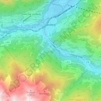
Nombre: Mapa topográfico Landeck, altitud, relieve.
Lugar: Landeck, Bezirk Landeck, 6500, Austria (47.09818 10.52642 47.15665 10.60537)
Altitud media: 1.325 m
Altitud mínima: 764 m
Altitud máxima: 2.582 m
Otros mapas topográficos
Haga clic en un mapa para ver su topografía, su altitud y su relieve.