
Mapa topográfico Sugar Mountain
Mapa interactivo
Haga clic en el mapa para ver la altitud.
Acerca de este mapa
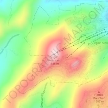
Nombre: Mapa topográfico Sugar Mountain, altitud, relieve.
Altitud media: 1.385 m
Altitud mínima: 1.211 m
Altitud máxima: 1.584 m
Sugar Mountain is a mountain in the North Carolina High Country and wholly in the Pisgah National Forest. Its elevation reaches 5,236 feet (1,596 m) and is split along the Eastern Continental Divide, generating feeder streams for the Linville, Elk, and North Toe rivers. On its north slope resides the Village of Sugar Mountain.