
Mapa topográfico Laurel
Haga clic en el mapa para ver la altitud.
Acerca de este mapa
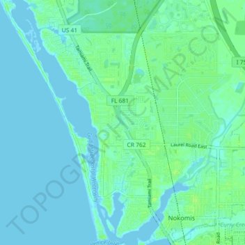
Nombre: Mapa topográfico Laurel, altitud, relieve.
Lugar: Laurel, Sarasota County, Florida, United States (27.11215 -82.48712 27.17606 -82.43567)
Altitud media: 3 m
Altitud mínima: -2 m
Altitud máxima: 10 m
Otros mapas topográficos
Haga clic en un mapa para ver su topografía, su altitud y su relieve.
Venice
United States > Florida > Sarasota County
Venice is characterized by its predominantly flat terrain, situated at an elevation of approximately 15 feet above sea level. This coastal city features sandy beaches along the Gulf of Mexico and is interspersed with various waterways, including canals and lakes that contribute to its scenic environment. The…
Altitud media: 3 m
North Port
United States > Florida > Sarasota County
North Port features a predominantly flat and low-lying topography characteristic of the region. The area is situated at an elevation of approximately 20 feet above sea level, with much of the terrain comprising wetlands, pine forests, and small lakes, interspersed with residential developments. The Myakka…
Altitud media: 6 m
Sarasota
United States > Florida > Sarasota County
Sarasota is characterized by predominantly flat topography with an average elevation of about 25 feet (approximately 8 meters) above sea level. The area features gently rolling terrain and is primarily composed of coastal plains. These low-lying regions are interspersed with wetlands and several small lakes,…
Altitud media: 7 m
Toll Brothers at Venice Woodlands
United States > Florida > Sarasota County > Venice
Altitud media: 5 m