

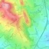
Mapa topográfico Upper Bentley
Haga clic en el mapa para ver la altitud.
Acerca de este mapa

Nombre: Mapa topográfico Upper Bentley, altitud, relieve.
Altitud media: 109 m
Altitud mínima: 65 m
Altitud máxima: 154 m
Otros mapas topográficos
Haga clic en un mapa para ver su topografía, su altitud y su relieve.

Bromsgrove
United Kingdom > England > Worcestershire > Bromsgrove > Lickey End
The solid geology of Bromsgrove is that of the Triassic (late Scythian to early Ladinian) Bromsgrove Sandstone. It shows red bed facies and was probably laid down by rivers flowing through an arid landscape or in ephemeral, shallow lakes. The uppermost beds were deposited by a brief marine transgression. The…
Altitud media: 119 m
Lickey Hills Country Park
United Kingdom > England > Worcestershire > Bromsgrove > Cofton Hackett CP
Altitud media: 209 m


Sanders Park
United Kingdom > England > Worcestershire > Bromsgrove > Bromsgrove > Lickey End
Altitud media: 96 m
Bromsgrove
United Kingdom > England > Worcestershire > Bromsgrove > Lickey End
The solid geology of Bromsgrove is that of the Triassic (late Scythian to early Ladinian) Bromsgrove Sandstone. It shows red bed facies and was probably laid down by rivers flowing through an arid landscape or in ephemeral, shallow lakes. The uppermost beds were deposited by a brief marine transgression. The…
Altitud media: 114 m

