
Haz una donación
Mapa topográfico Petaluma
Haga clic en el mapa para ver la altitud.
Haz una donación
Acerca de este mapa
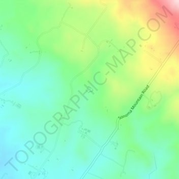
Nombre: Mapa topográfico Petaluma, altitud, relieve.
Lugar: Petaluma, Sonoma County, California, United States (38.29490 -122.61442 38.29581 -122.61301)
Altitud media: 131 m
Altitud mínima: 40 m
Altitud máxima: 330 m
Haz una donación
Otros mapas topográficos
Haga clic en un mapa para ver su topografía, su altitud y su relieve.
Russian River
United States > California > Sonoma County > Guerneville > El Bonita
The geographer R. S. Holway wrote of the Russian River in his 1917 paper "The Russian River: A Characteristic Stream of the California Coast Ranges". Originally, the Russian River was one of several rivers draining westward from the Mayacamas Mountains through the Mendocino Plateau to the sea, a region lifted…
Altitud media: 180 m
Haz una donación
Haz una donación
Sonoma Mountain
United States > California > Sonoma County
Sonoma Mountain is a prominent landform within the Sonoma Mountains of southern Sonoma County, California. At an elevation of 2,463 ft (751 m), Sonoma Mountain offers expansive views of the Pacific Ocean to the west and the Sonoma Valley to the east. In fact, the viticultural area extends in isolated patches…
Altitud media: 593 m
Haz una donación
Sebastopol
United States > California > Sonoma County > Sebastopol > Sebastopol
Sebastopol's elevation is 65 to 250 feet (20 to 76 meters) above sea level. Its downtown is at the intersection of State Route 12 and State Route 116 (Gravenstein Highway), approximately 9 mi (14 km) west of U.S. Route 101.
Altitud media: 41 m
Haz una donación
Haz una donación
Haz una donación