
Haz una donación
Mapa topográfico Calipatria
Haga clic en el mapa para ver la altitud.
Haz una donación
Calipatria
At an elevation of 180 feet (55 m) below sea level, Calipatria is the lowest incorporated city in the Western Hemisphere. The city currently claims to have the "tallest flagpole (184 feet) where the flag flies at sea level" at 184 feet (56 m), so their American flag will always fly above sea level. According to the Guinness Book of World Records, the Jeddah Flagpole holds the title of world's tallest, but it is entirely above sea level.
Haz una donación
Acerca de este mapa
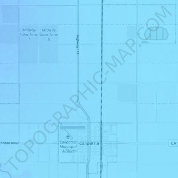
Nombre: Mapa topográfico Calipatria, altitud, relieve.
Altitud media: -54 m
Altitud mínima: -63 m
Altitud máxima: -45 m
Haz una donación
Otros mapas topográficos
Haga clic en un mapa para ver su topografía, su altitud y su relieve.
Salton Sea
United States > California > Imperial County
The Gulf of California would extend as far north as the city of Indio, were it not for the delta created by the Colorado River. Over three million years, through all of the Pleistocene, the river's delta expanded until it cut off the northern part of the gulf. Since then, the Colorado River has alternated…
Altitud media: 9 m
Salton City
United States > California > Imperial County
In the 1970s, most of the buildings constructed along the shoreline, including the city's marina were abandoned due to rising sea elevation. In the 1980s, the Imperial Irrigation District took proactive water conservation measures to reduce the flow of unused canal water into the Salton Sea. Throughout the…
Altitud media: -40 m
Salton Sea
United States > California > Imperial County
The Gulf of California would extend as far north as the city of Indio, some 150 miles (240 km) northwest of its current limits, were it not for the delta created by the Colorado River. Over three million years, through all of the Pleistocene, the river's delta expanded until it cut off the northern part of the…
Altitud media: 9 m
Haz una donación
Salton Sea
United States > California > Imperial County
The Gulf of California would extend as far north as the city of Indio, were it not for the delta created by the Colorado River. Over three million years, through all of the Pleistocene, the river's delta expanded until it cut off the northern part of the gulf. Since then, the Colorado River has alternated…
Altitud media: 9 m
Haz una donación
Brawley
United States > California > Imperial County > Brawley
Brawley is located in the Colorado Desert and Lower Colorado River Valley regions. The city's elevation, like other Imperial Valley towns, is below sea level.
Altitud media: -44 m