
Mapa topográfico Inyokern
Mapa interactivo
Haga clic en el mapa para ver la altitud.
Acerca de este mapa
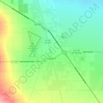
Nombre: Mapa topográfico Inyokern, altitud, relieve.
Lugar: Inyokern, Kern County, California, United States (35.62268 -117.87212 35.68164 -117.77582)
Altitud media: 753 m
Altitud mínima: 703 m
Altitud máxima: 848 m
Inyokern (formerly Siding 16 and Magnolia) is a census-designated place (CDP) in Kern County, California, United States. Its name derives from its location near the border between Inyo and Kern Counties. Inyokern is located 8 miles (13 km) west of Ridgecrest, at an elevation of 2,434 feet (742 m). It is on the western side of the Indian Wells Valley. The population was 988 in the 2020 census, down from 1,099 in the 2010 census. It was a railroad town established along the Southern Pacific railroad's Lone Pine Branch (now removed) and with WWII became site of the Naval Air Weapons Station China Lake.