
Gracias por apoyar a este sitio ❤️
Haz una donación
Haz una donación
Mapa topográfico Tabor Hill
Haga clic en el mapa para ver la altitud.
Gracias por apoyar a este sitio ❤️
Haz una donación
Haz una donación
Acerca de este mapa
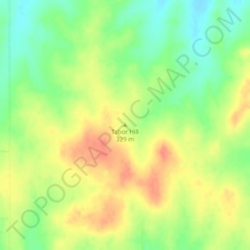
Nombre: Mapa topográfico Tabor Hill, altitud, relieve.
Lugar: Tabor Hill, Wabaunsee County, Kansas, United States (39.11217 -96.07893 39.11227 -96.07883)
Altitud media: 325 m
Altitud mínima: 299 m
Altitud máxima: 348 m
Gracias por apoyar a este sitio ❤️
Haz una donación
Haz una donación
Otros mapas topográficos
Haga clic en un mapa para ver su topografía, su altitud y su relieve.
Maple Hill
United States > Kansas > Wabaunsee County
Maple Hill was founded about 1882. It was named from a grove of maple trees growing upon an elevation.
Altitud media: 298 m
Maple Hill
United States > Kansas > Wabaunsee County
Maple Hill was founded about 1882. It was named from a grove of maple trees growing upon an elevation.
Altitud media: 298 m