
Gracias por apoyar a este sitio ❤️
Haz una donación
Haz una donación
Mapa topográfico Maglič
Haga clic en el mapa para ver la altitud.
Gracias por apoyar a este sitio ❤️
Haz una donación
Haz una donación
Acerca de este mapa
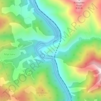
Nombre: Mapa topográfico Maglič, altitud, relieve.
Altitud media: 452 m
Altitud mínima: 241 m
Altitud máxima: 812 m
Gracias por apoyar a este sitio ❤️
Haz una donación
Haz una donación
Otros mapas topográficos
Haga clic en un mapa para ver su topografía, su altitud y su relieve.
Stolovi
Serbia > Central Serbia > Raska Administrative District > Kraljevo City
Stolovi (Serbian Cyrillic: Столови) is a mountain in central Serbia, near the city of Kraljevo. Its highest peak Usovica has an elevation of 1,356 meters above sea level.
Altitud media: 1.059 m