
Mapa topográfico Bennachie
Mapa interactivo
Haga clic en el mapa para ver la altitud.
Acerca de este mapa
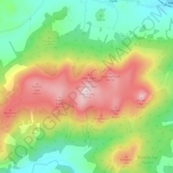
Nombre: Mapa topográfico Bennachie, altitud, relieve.
Lugar: Bennachie, Auchleven, Aberdeenshire, Scotland, United Kingdom (57.28142 -2.61815 57.30704 -2.51634)
Altitud media: 262 m
Altitud mínima: 84 m
Altitud máxima: 516 m
Mither Tap has an astronomical alignment with the nearby Pictish Fortalice of Caskieben (currently located within Keith Hall). Dr. Arthur Johnston said "the hill of Benochie, a conical elevation about eight miles distant, casts its shadow over Caskieben at the periods of the equinox."