
Mapa topográfico Breathitt County
Mapa interactivo
Haga clic en el mapa para ver la altitud.
Acerca de este mapa
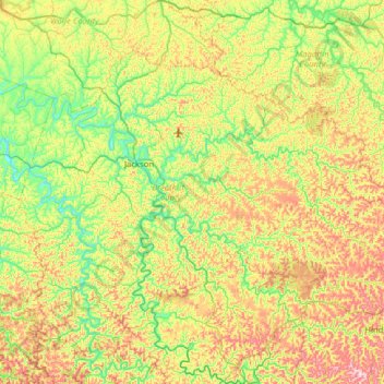
Nombre: Mapa topográfico Breathitt County, altitud, relieve.
Lugar: Breathitt County, Kentucky, United States (37.33004 -83.58037 37.69994 -82.94854)
Altitud media: 341 m
Altitud mínima: 201 m
Altitud máxima: 590 m
Otros mapas topográficos
Haga clic en un mapa para ver su topografía, su altitud y su relieve.
Canoe
United States > Kentucky > Breathitt County
Canoe, Breathitt County, Kentucky, United States
Altitud media: 299 m
Haddix
United States > Kentucky > Breathitt County
Haddix, Breathitt County, Kentucky, United States
Altitud media: 295 m