
Gracias por apoyar a este sitio ❤️
Haz una donación
Haz una donación
Mapa topográfico Shell Knob
Haga clic en el mapa para ver la altitud.
Gracias por apoyar a este sitio ❤️
Haz una donación
Haz una donación
Acerca de este mapa
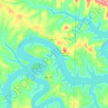
Nombre: Mapa topográfico Shell Knob, altitud, relieve.
Lugar: Shell Knob, Barry County, Missouri, United States (36.57032 -93.64132 36.64041 -93.56318)
Altitud media: 306 m
Altitud mínima: 268 m
Altitud máxima: 406 m
Gracias por apoyar a este sitio ❤️
Haz una donación
Haz una donación
Otros mapas topográficos
Haga clic en un mapa para ver su topografía, su altitud y su relieve.