
Mapa topográfico Getsvedjeberget
Mapa interactivo
Haga clic en el mapa para ver la altitud.
Acerca de este mapa
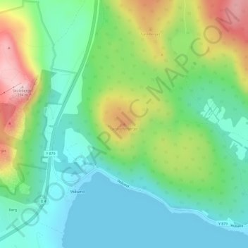
Nombre: Mapa topográfico Getsvedjeberget, altitud, relieve.
Altitud media: 92 m
Altitud mínima: -1 m
Altitud máxima: 284 m
Otros mapas topográficos
Haga clic en un mapa para ver su topografía, su altitud y su relieve.
Värns
Sweden > Västernorrland County > Vibyggerå District > Värns
Värns, Vibyggerå District, Kramfors kommun, Västernorrland County, Region Norrland, Sweden
Altitud media: 31 m