
Mapa topográfico Blauwe Hand
Mapa interactivo
Haga clic en el mapa para ver la altitud.
Acerca de este mapa
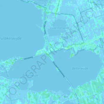
Nombre: Mapa topográfico Blauwe Hand, altitud, relieve.
Altitud media: -1 m
Altitud mínima: -5 m
Altitud máxima: 6 m
Otros mapas topográficos
Haga clic en un mapa para ver su topografía, su altitud y su relieve.
Ronduite
Nederland > Overijssel > Wanneperveen
Ronduite, Wanneperveen, Steenwijkerland, Overijssel, Nederland, 8066 PA, Nederland
Altitud media: -1 m