

Haz una donación
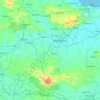
Mapa topográfico Jangkar
Haga clic en el mapa para ver la altitud.
Haz una donación
Acerca de este mapa

Nombre: Mapa topográfico Jangkar, altitud, relieve.
Lugar: Jangkar, Situbondo, East Java, Java, 68373, Indonesia (-7.75857 114.16857 -7.67857 114.24857)
Altitud media: 13 m
Altitud mínima: -1 m
Altitud máxima: 53 m
Haz una donación
Otros mapas topográficos
Haga clic en un mapa para ver su topografía, su altitud y su relieve.


Haz una donación

Haz una donación


Haz una donación

Haz una donación
Blitar
Blitar is a landlocked city in East Java, Indonesia, about 73 km from Malang and 167 km from Surabaya. The area lies within longitude 111° 40' – 112° 09' East and its latitude is 8° 06' South. The city of Blitar lies at an altitude on average 167 metres above sea level, and is an enclave within Blitar…
Altitud media: 180 m

Haz una donación
Malang
The city was capital city of Singhasari in 1222, then transferred to Dutch colony. Malang was modernized under the Dutch; its mild climate which results from its elevation, along with its proximity to the major port of Surabaya, made it a popular destination for the Dutch and other Europeans. Malang began to…
Altitud media: 490 m


Haz una donación

Sidoarjo
Administratively, Sidoarjo Regency is divided into 18 districts, 28 urban villages (kelurahan), and 318 rural villages (desa). The most densely populated districts are located in the northern part, such as Waru and Taman, which serve as gateways to Surabaya and centers of urbanization. Meanwhile, coastal areas…
Altitud media: 59 m
Haz una donación

Batu
In the 19th century, the Dutch East Indies government developed Batu as a mountain resort. Villas and resort facilities were built in Batu during the period. Most of the topography of Batu City is dominated by highland and hilly terrain with valleys running down mountain slopes. In northern Batu, there is a…
Altitud media: 1.365 m


Haz una donación


Haz una donación


Haz una donación

Sidoarjo
Administratively, Sidoarjo Regency is divided into 18 districts, 28 urban villages (kelurahan), and 318 rural villages (desa). The most densely populated districts are located in the northern part, such as Waru and Taman, which serve as gateways to Surabaya and centers of urbanization. Meanwhile, coastal areas…
Altitud media: 59 m
Haz una donación

Malang
Indonesia > East Java > Kota Malang
The city was capital city of Singhasari in 1222, then transferred to Dutch colony. Malang was modernized under the Dutch; its mild climate which results from its elevation, along with its proximity to the major port of Surabaya, made it a popular destination for the Dutch and other Europeans. Malang began to…
Altitud media: 490 m
Haz una donación



Haz una donación
Malang
Indonesia > East Java > Kota Malang
The city was capital city of Singhasari in 1222, then transferred to Dutch colony. Malang was modernized under the Dutch; its mild climate which results from its elevation, along with its proximity to the major port of Surabaya, made it a popular destination for the Dutch and other Europeans. Malang began to…
Altitud media: 490 m
Haz una donación

Haz una donación


Haz una donación
Haz una donación

Malang
Indonesia > East Java > Kota Malang
The city was capital city of Singhasari in 1222, then transferred to Dutch colony. Malang was modernized under the Dutch; its mild climate which results from its elevation, along with its proximity to the major port of Surabaya, made it a popular destination for the Dutch and other Europeans. Malang began to…
Altitud media: 490 m


Haz una donación

Haz una donación


Haz una donación


Haz una donación


Haz una donación


Haz una donación
Haz una donación


Tulungagung
Topographically, Tulungagung Regency is located 85 m (279 ft) above the sea level. The northwest part of the regency is a portion of the Wilis-Liman mountain range; the central part is lowland; the southern part is a portion of the rocky Kapur Kidul mountain range which is also an enormous source of marble. In…
Altitud media: 263 m
Haz una donación