
Gracias por apoyar a este sitio ❤️
Haz una donación
Haz una donación
Mapa topográfico Denpasar
Haga clic en el mapa para ver la altitud.
Gracias por apoyar a este sitio ❤️
Haz una donación
Haz una donación
Denpasar
Denpasar is located at an elevation of 4 m (13 ft) above sea level. While the total area of 125.98 km2 or 2.18% of the total area of Bali Province. From the use of land, 2,768 hectares of land are paddy, 10,001 hectares are dry land, while the remaining land area is 9 hectares.
Gracias por apoyar a este sitio ❤️
Haz una donación
Haz una donación
Acerca de este mapa
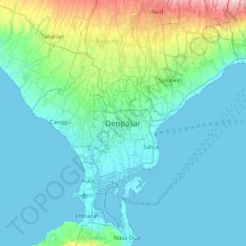
Nombre: Mapa topográfico Denpasar, altitud, relieve.
Altitud media: 48 m
Altitud mínima: -1 m
Altitud máxima: 315 m
Gracias por apoyar a este sitio ❤️
Haz una donación
Haz una donación