
Haz una donación
Mapa topográfico Seligman
Haga clic en el mapa para ver la altitud.
Haz una donación
Seligman
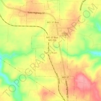
Seligman is located in the Ozarks and is, bordered by the Mark Twain National Forest to the east. The town is located on a ridge along Missouri Route 37. Rainfall west of the railroad flows into the Grand Lake o' the Cherokees by way of Big Sugar Creek and Cowskin River. Rainfall to the east of Seligman flows to Table Rock Lake by way of Dry Hollow, Blockade Hollow, and Butler Hollow. The region also hosts Karst topography, characterized by high limestone content and the formation of sinkholes and caves.
Haz una donación
Acerca de este mapa
Nombre: Mapa topográfico Seligman, altitud, relieve.
Lugar: Seligman, Barry County, Missouri, United States (36.50638 -93.95108 36.53645 -93.92861)
Altitud media: 467 m
Altitud mínima: 410 m
Altitud máxima: 505 m
Haz una donación
Otros mapas topográficos
Haga clic en un mapa para ver su topografía, su altitud y su relieve.
Haz una donación
Haz una donación