
Mapa topográfico Devin
Mapa interactivo
Haga clic en el mapa para ver la altitud.
Devin
The Devinska river runs through it and numerous other brooks and rivers (namely Krichim, Muglenska and Trigradska) are found nearby, all tributaries of the Vacha river. The altitude is uneven owing to the mountainous location, ranging from 684 m to around 800 m above sea level.
Acerca de este mapa
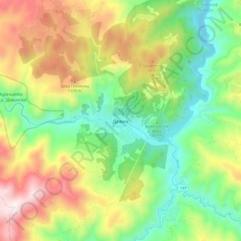
Nombre: Mapa topográfico Devin, altitud, relieve.
Lugar: Devin, Smolyan, 4800, Bulgaria (41.70336 24.35846 41.78336 24.43846)
Altitud media: 1.051 m
Altitud mínima: 637 m
Altitud máxima: 1.676 m