
Gracias por apoyar a este sitio ❤️
Haz una donación
Haz una donación
Mapa topográfico Kankakee
Haga clic en el mapa para ver la altitud.
Gracias por apoyar a este sitio ❤️
Haz una donación
Haz una donación
Kankakee
Greater Kankakee Airport covers an area of 950 acres (380 ha) (384 ha) at an elevation of 629 feet (192 m) above mean sea level. It has two runways with asphalt surfaces: 4/22 is 5,981 by 100 feet (1,823 x 30 m) and 16/34 is 4,398 by 75 feet (1,341 x 23 m).
Gracias por apoyar a este sitio ❤️
Haz una donación
Haz una donación
Acerca de este mapa
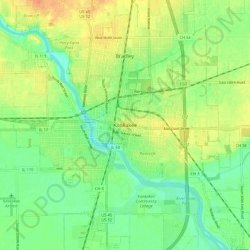
Nombre: Mapa topográfico Kankakee, altitud, relieve.
Lugar: Kankakee, Kankakee County, Illinois, 60901, United States (41.08003 -87.90115 41.16003 -87.82115)
Altitud media: 195 m
Altitud mínima: 178 m
Altitud máxima: 214 m
Gracias por apoyar a este sitio ❤️
Haz una donación
Haz una donación