
Mapa topográfico 于都县
Mapa interactivo
Haga clic en el mapa para ver la altitud.
Acerca de este mapa
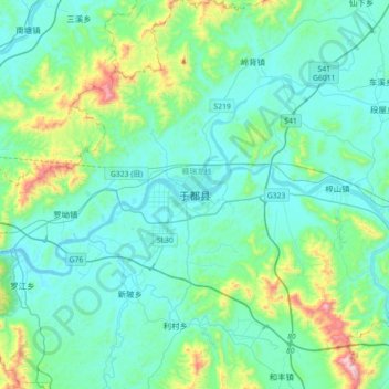
Nombre: Mapa topográfico 于都县, altitud, relieve.
Lugar: 于都县, 赣州市, 江西省, 中国 (25.79437 115.25047 26.11437 115.57047)
Altitud media: 242 m
Altitud mínima: 104 m
Altitud máxima: 949 m
Otros mapas topográficos
Haga clic en un mapa para ver su topografía, su altitud y su relieve.