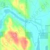
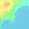
Mapa topográfico Huron
Haga clic en el mapa para ver la altitud.
Acerca de este mapa

Nombre: Mapa topográfico Huron, altitud, relieve.
Lugar: Huron, Michigan, 48413, United States (43.13857 -83.72220 44.53857 -82.32220)
Altitud media: 197 m
Altitud mínima: 172 m
Altitud máxima: 427 m
Otros mapas topográficos
Haga clic en un mapa para ver su topografía, su altitud y su relieve.


Saginaw County
According to the U.S. Census Bureau, the county has a total area of 816 square miles (2,110 km2), of which 800 square miles (2,100 km2) is land and 16 square miles (41 km2) (1.9%) is water. It is part of the Flint/Tri-Cities region of Mid-Michigan. The median elevation in Saginaw County, Michigan is 620 feet…
Altitud media: 193 m



Grand River
The Grand River is a major tributary of Lake Michigan. It falls in elevation from 1260 ft. in the highlands of its headwaters to 577 ft. at its mouth on Lake Michigan. Its waters drain northward through the lake, then south and east through the Great Lakes waterways into the St. Lawrence River, which flows…
Altitud media: 264 m


Highland State Recreation Area
United States > Michigan > Oakland County > Highland
West of Duck Lake Road in Highland State Recreation Area, a group of small moraines are locally called "mountains"—the highest elevation in the park, Mount Kanzer, is 1,150 feet (350 m) above sea level. The highland for which this recreation area is named is this group of moraines.
Altitud media: 302 m













Veterans Park
United States > Michigan > Oakland County > Highland Charter Township
Altitud media: 310 m


Mullet Lake Village Boating Access Site
United States > Michigan > Cheboygan County
Altitud media: 185 m