
Mapa topográfico Lavamünd
Mapa interactivo
Haga clic en el mapa para ver la altitud.
Acerca de este mapa
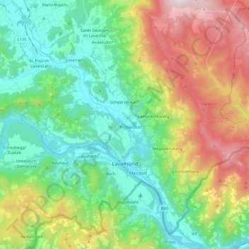
Nombre: Mapa topográfico Lavamünd, altitud, relieve.
Lugar: Lavamünd, Bezirk Wolfsberg, Carinthia, 9473, Austria (46.60140 14.85436 46.72871 15.06515)
Altitud media: 768 m
Altitud mínima: 326 m
Altitud máxima: 1.688 m
Lavamünd lies in the southeast of Carinthia, close to the border with Slovenia (Slovene Carinthia). It is situated at the confluence of the Lavant and Drava rivers. In the northeast, the Soboth Pass leads across the Koralpe range to Eibiswald in Styria. At an elevation of 348 m (1,142 ft) AA, the area is the lowest part of Carinthia.
Otros mapas topográficos
Haga clic en un mapa para ver su topografía, su altitud y su relieve.
Soboth
Austria > Carinthia > Bezirk Wolfsberg > Lavamünd
Soboth, Lavamünd, Bezirk Wolfsberg, Carinthia, 9473, Austria
Altitud media: 1.231 m