
Mapa topográfico Place Fell
Haga clic en el mapa para ver la altitud.
Place Fell
Place Fell can be climbed from Patterdale, either via Boredale Hause or more directly by aiming up the face between Bleaberry Knott and The Knight. Ascents can also be made from Sandwick up either of the north eastern ridges, or from Boredale via the Hause. The altitude gain from the shores of Ullswater to the peak of Place Fell is 512 m (1,680 ft), but trails have shallow gradients and no hands-on scrambling is required; scrambling opportunities are few, even off-trail.
Acerca de este mapa
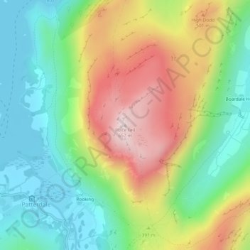
Nombre: Mapa topográfico Place Fell, altitud, relieve.
Altitud media: 341 m
Altitud mínima: 145 m
Altitud máxima: 653 m
Otros mapas topográficos
Haga clic en un mapa para ver su topografía, su altitud y su relieve.
Brothers Water
United Kingdom > England > Westmorland and Furness > Patterdale > Hartsop
Altitud media: 298 m