
Gracias por apoyar a este sitio ❤️
Haz una donación
Haz una donación
Mapa topográfico Max Meadows
Haga clic en el mapa para ver la altitud.
Gracias por apoyar a este sitio ❤️
Haz una donación
Haz una donación
Acerca de este mapa
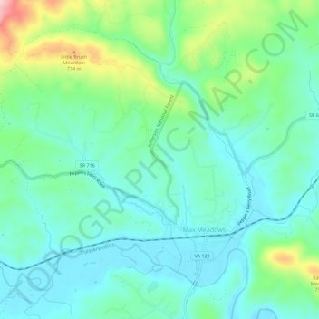
Nombre: Mapa topográfico Max Meadows, altitud, relieve.
Lugar: Max Meadows, Wythe County, Virginia, United States (36.96319 -80.99734 36.99965 -80.94156)
Altitud media: 662 m
Altitud mínima: 606 m
Altitud máxima: 830 m
Gracias por apoyar a este sitio ❤️
Haz una donación
Haz una donación
Otros mapas topográficos
Haga clic en un mapa para ver su topografía, su altitud y su relieve.
Gracias por apoyar a este sitio ❤️
Haz una donación
Haz una donación
Gracias por apoyar a este sitio ❤️
Haz una donación
Haz una donación